
آيسك تقنية اليوم
لمشاريع الغد
نجمع بين أحدث التقنيات والخبرة العميقة لتقديم حلول مبتكرة في عالم البناء.


من آيسك؟
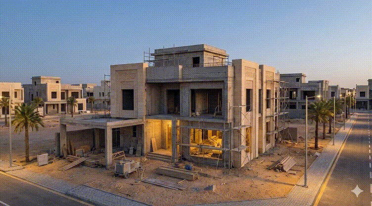
آيسك شركة ناشئة متخصصة في تكنولوجيا البناء، تقدم حلولاً مبتكرة تعتمد على الذكاء الاصطناعي والواقع المعزز لتحسين إدارة المشاريع، وتمكين فرق العمل من فهم البيانات المعقدة، تعزيز الإشراف، ورفع كفاءة التنفيذ في جميع مراحل المشروع.
تركز آيسك على تطوير تقنيات تعزز التعاون بين الفرق، تقلل الأخطاء، وتسهّل اتخاذ القرارات الدقيقة، لتسريع إنجاز المشاريع وتحقيق أعلى مستويات الجودة والكفاءة في مواقع البناء.
لماذا آيسك؟
حيث تلتقي الخبرة الرائدة بالذكاء الاصطناعي والواقع المعزز لرفع مستوى كل مشروع إلى آفاق جديدة.

تقليل التكاليف
نساعد الشركات على خفض التكاليف التشغيلية عبر تقليل الأخطاء، الحد من إعادة العمل، وتحسين وضوح البيانات واتخاذ القرار.

تسريع الجداول الزمنية
نمكّن فرق المشاريع من اتخاذ قرارات أسرع وأكثر دقة، مما يقلل التأخير ويسرّع تنفيذ المشاريع.

تحسين التعاون والإشراف
نعزّز التكامل والتواصل بين فرق التصميم والموقع والعمليات، مع إشراف أدق وتفتيش أكثر سلاسة طوال دورة المشروع.
منتجاتنا
نجمع بين أحدث التقنيات والخبرة العميقة لتقديم حلول مبتكرة في عالم البناء.
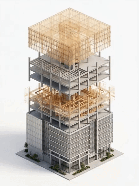
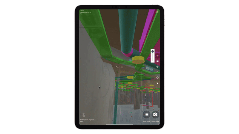
منصة آيسك
حل رقمي موحد للويب والجوال يستخدم الواقع المعزز (AR) لمقارنة المخططات بالواقع.
اقرأ أقلالمميزات
- واقع معزز لمطابقة المخططات مع الموقع
- متابعة ذكية لتقدم المشروع
- تواصل مركزي بين فرق العمل
- نظام تذاكر لإدارة الملاحظات
خدماتنا
حيث تلتقي الخبرة الرائدة بالذكاء الاصطناعي والواقع المعزز لرفع مستوى كل مشروع إلى آفاق جديدة.

تواصل معنا
هل أنت مستعد لتحقيق رؤيتك؟ فريقنا هنا لمساعدتك.